
Better blue whale habitat is indicated by increasingly red colors, showing where the likelihood of blue whale presence is higher. Poorer blue whale habitat is indicated by increasingly blue colors, showing where the likelihood of blue whale presence is lower. If blues whales are present in the area, the map indicates where they are most likely to be.
Each day the WhaleWatch 2.0 tool generates predictions of the spatial distributions of blue whales based on an ensemble of models predicting blue whale habitat suitability from current ocean conditions. For detailed methodology of model building, see the study published about the product. This is an update to the previous WhaleWatch effort that was at 25km resolution and updated monthly (URL).
Daily ocean conditions such as sea surface temperature, locations of frontal zones, and water column properties are sourced from a near-real-time data-assimilative configuration of the Regional Ocean Modeling System for the California Current System.
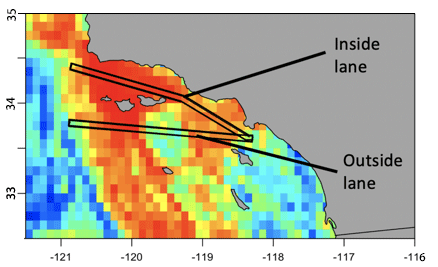
This indicator shows daily whale habitat suitability within the primary shipping approach north of the Channel islands and the southern undesignated approach in the Southern California Bight. This type of information allows managers to understand shipstrike risk exposure in shipping lanes within and among years as a function of environmental conditions, allowing for informed decision-making regarding vessel speed reductions.